My Adventurous Life with Arthritis
I have RA, but RA doesn't Have Me!
Needles Highway, Iron Mountain Road and Pigtale Bridges
This morning was a cold crisp mountain morning. The kind of morning you look around the campground and are thankful you are not in a tent. Don’t get me wrong, in my younger years, when I could actually get up and down off the ground, I loved tent camping, except when it was cold and I didn’t want to get out of my sleeping bag and this was that kind of cold morning. Thankfully I was able to get dressed in the warmth of the truck camper before preparing breakfast and hitting the road for a day of site seeing.
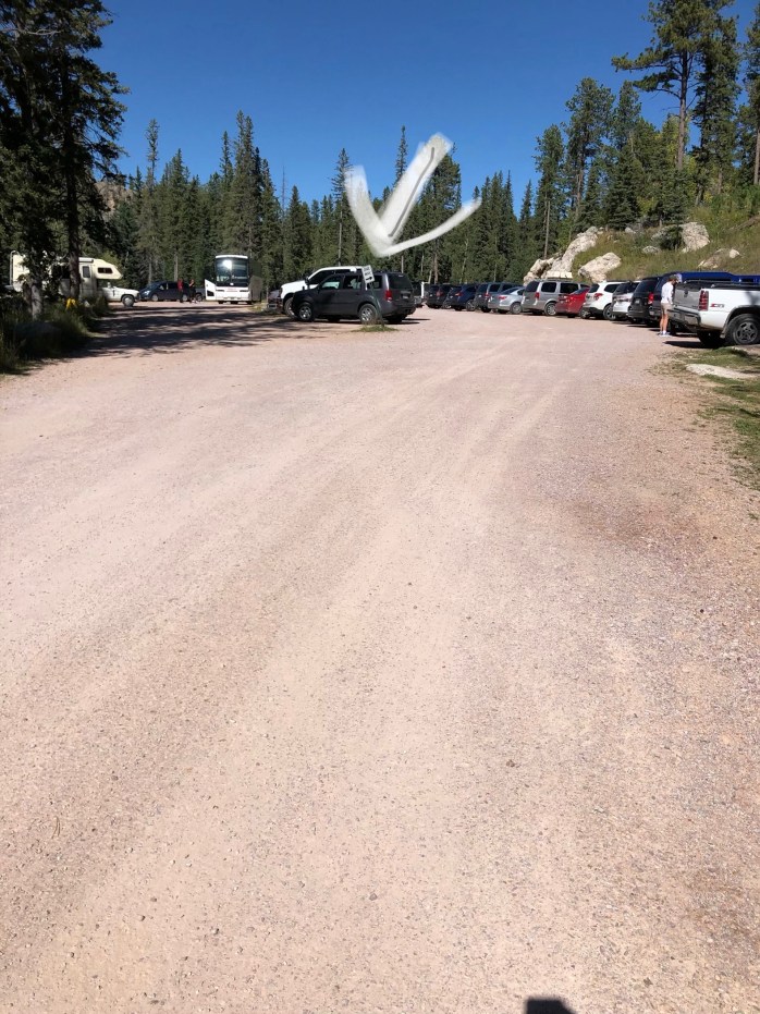
Needles Highway was one of Chip’s “go-to places” that was on his list. We purposefully stayed at a “real” campground, so we could leave our camper behind because of the low clearance tunnels. When you see our pictures, you will definitely understand why we did not have the camper on the truck.

Needles Highway was the vision of Peter Norbeck who was the South Dakota Governor in the early 1920s. Norbeck laid out the entire highway on foot and horseback; imagine what a task this was back in the day.
We took some awesome pictures, but I had to share this one that is an aerial view to show you just how curvy the road was and of course, we couldn’t do an aerial view so this is compliments of this site which describes in more detail about the Needles Highway.
https://www.visitrapidcity.com/things-to-do/black-hills-cruising/needles-highway
Some of our pictures of the views and narrow tunnels.


One of the go-to places while in Custer State Park and off the Needles Highway was the Black Elk Fire Tower aka Harney Peak. The tower is the highest point in South Dakota with an elevation of 7242.
This is a picture from a google search, as I was trying to show how far away we were, you know 22 miles, but I couldn’t find anything. This is an aerial view that shows the beauty of the fire tower.
![]()
I love to hike, and we were prepared for this journey with our walking poles, water, and snacks. There were a lot of people heading up the trail, of all ages, so I thought, “how hard could it be.” The initial part of the hike wasn’t bad, but I remember stopping along the way at an overlook and Chip pointing way off, and I mean way off, across mountain tops, sat this small building formation and he said: “that’s where we are going.” I should have been a little more suspicious when we had to sign a paper and deposit it that we were walking this trail. Is that so they know who to go look for that didn’t make it out?
")


Now in my mind, it seemed impossible we would ever get to that point. I mean it was so far away I was concerned we didn’t have enough food and water as I wasn’t sure we could make it in a day. But we kept trudging along. People amazed me as they would pass us as if we were walking too slow, and then low and behold 10 minutes later we would pass them because they stopped to rest. This happened time and time again. We never stopped and rested, we just kept an even pace and beat them to the top. Yes, it became a contest for me, and I do not like to lose. The closer we got to the summit the tougher the hike was, but in the end, it was definitely worth the exhaustion. The view was amazing and quite honestly, I was still amazed we made it across all those valleys and mountains on the same day. I told everyone we hiked 22 miles up the mountain to get to the peak and Chip continues to correct me that it was just over 7 miles round trip. It was the longest 7 miles I have ever been on that is for sure.


")
")
Because I do not like seeing the same thing twice, and quite honestly, I was not looking forward to going back down some of the steps we went up, we elected to take a different trail back down the mountain.


It was definitely a much easier hike but a lot longer. I remember seeing a parking lot in the distance and was thinking in my mind, “thank you Jesus” when Chip said, “don’t get excited over there, that is not our parking lot”. Boy, he had no clue how disappointed I was. I did scope out some of the cars and I really thought about asking someone to take us to our parking lot, but I didn’t as I am sure I would have been riding by myself and I would see Chip walking off in the rearview mirror. I reluctantly continued to follow Chip along the trail, silently praying every corner we went around that I would see the parking lot with our truck. Chip kindly reminded me more than once we would already be at the truck if we had gone back down the mountain on the same trail we went up. He may have been right, but I still am glad we took a different route out.
When we finally did see our truck, I snapped this picture and sent it to Bailey. She replied with a question so I added the message “I have never been so happy to see my truck”.
At the time I told Chip if we ever came back out there with Bailey, he would have to accompany her to the top, that I would be waiting on a bench at the bottom. I said I would not go back up that hike again but honestly now that I have recovered, I really would hike back up and yes, I would still come back down the long way.
Once we got back to the truck, we decided to ride back into the town of Custer and walk around. I was intrigued by the buffalo statues around town. They were neat but not as neat as the pigs in Lexington NC. I may be biased since I love pigs.


While we were in Custer, we found a wonderful ice cream store, Horatio’s Homemade Ice Cream. They actually had dairy-free ice cream, so I splurged and had a scoop or two. I did get my scoops in a waffle cone because who can pass up a waffle cone. The nice lady did tell me the waffle cone did have dairy in it, but I smiled and said a little bit wouldn’t kill me, and p.s. it didn’t.
One of the other highways we rode was Iron Mountain Road and the Pigtail Bridges. Norbeck wanted to create a highway with tunnels that would frame Mount Rushmore. It is known as one of the most crooked roads you’ll ever drive, and it definitely was.


When you came through the tunnel you could see Mount Rushmore.

It too has an interesting history that you can read about it here. https://www.ironmountainroad.com/
Norbeck Scenic Byway consists of three roads, the Needles Highway, the Iron Mountain Road, and The Pigtail Bridges. The Peter Norbeck Scenic Byway was named one of the top 10 scenic drive by the Society of American Travel Writers. It is definitely a trip to plan if you go to South Dakota.
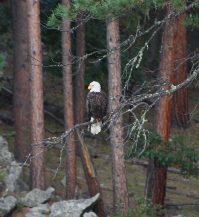
We ended our day riding off the beaten path, as usual, and was able to capture this beautiful picture of a bald eagle hunting for dinner.
Tomorrow we head to Spearfish Canyon, South Dakota.
